|
Welcome to the Louisiana Helicam blog!
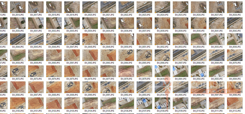
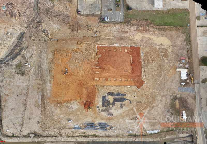
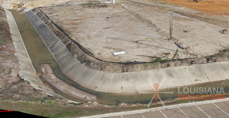
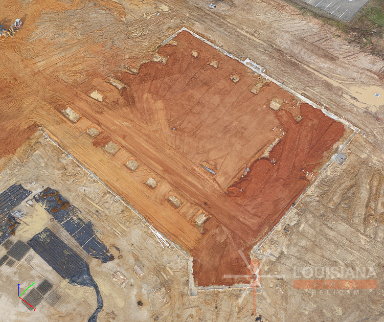
Egret Landing | Monroe, Louisiana Housing Development near CenturyLink Headquarters and IBM SiteThese images are from the latest aerial photo collection of the new Egret Landing residential development located in Monroe, Louisiana. The new subdivision is located just behind the Centurylink headquarters on highway 165 just North of Monroe. Construction on Phases II and III began in the Fall of 2016. More information can be found within the following links:
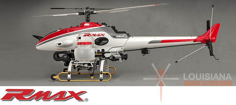
Yamaha RMAXThis blog post is based on our latest monthly article for a national pulp and paper publication. Yamaha RMAX The year was 2004 and I was still somewhat new to the world of radio-controlled helicopters. I spent many hours perusing websites, forums, and online articles about various flying machines. Although much of my time was centered on small consumer aircraft, I couldn’t refrain from being interested in one of the most impressive of all radio-controlled helicopters…the Yamaha RMAX.
The Yamaha RMAX was originally developed in 1997 for aerial agricultural spraying. It is powered by a water-cooled 2-stroke engine and has a flight duration of around 1 hour. The RMAX weighs just over 200lbs depending on payload configuration. The RMAX was much larger and seemingly more sophisticated than our typical Sunday afternoon flyers. However, a closer looked revealed it had similar components…only upscaled.
Louisiana Helicam primarily used glow-fueled helicopters for the first several years. Lithium polymer technology wasn’t far enough along to be considered a viable option at that time and I was really impressed with the RMAX’s duration when teamed with gasoline powered engines. My continued research into the Yamaha RMAX eventually led me to make the switch from glow-fueled aircraft to gasoline powered aircraft, which were used until electric power became a more convenient option. My first gas-powered helicopter had a 23cc engine. The engine utilized a pull rope rather than a 12v starter. The machine was reliable, efficient, and had an average flight duration of around 20 minutes.
As of 2015, the RMAX had conducted over 2 million combined flight hours since its first launch. The FAA added the RMAX to its list of approved UAS during that year. They are commonly used for spraying, seeding, remote sensing, precision agriculture, frost mitigation and variable rate dispersal.
Louisiana Helicam | 2016 Northeast Louisiana Flood RecapThis video contains leftover footage from the devastating flood that occurred in Northeast Louisiana between March 8th and March 12th of 2016. Very heavy rainfall developed during the afternoon of Tuesday March 8, 2016, and continued off and on through Saturday March 12. Rainfall amounts of over 20 inches were recorded in a few locations. Many locations experienced extreme flash flooding, particularly across East Texas and North Louisiana. Numerous roadways were flooded and closed. Many schools across the area were closed. Numerous high-water rescues were performed. Homes and businesses were evacuated in many locations. Many historical records were broken on area rivers and lakes.
Bank of Ruston | Monroe, Louisiana BranchSeveral recent aerials from the new Bank of Ruston branch located in Monroe, Louisiana. For more information:
West Monroe High School | Don Shows Field | Stadium Construction Photos - 2/12/17We recently had the opportunity to document the new Don Shows stadium construction project located at West Monroe High school. The project's construction was handled by Southern Bleacher of Graham, TX. Links of interest: Aerial Panoramic Image
Commercial Images
Aerial Drone Photogrammetry | February Mapping Blog | Part 2Louisiana Helicam writes monthly publication articles regarding drone/UAV/UAS usage in the pulp and paper industry. The February 2017 article is contained below: In last month’s article, we got a brief overview of Photogrammetry and how it is used for various applications. This month’s article will demonstrate the process that was used for a local church construction project. Step 1: Gather Aerial Imagery Gathering the aerial image collection is the first step in the process. There are many different types of drones, cameras, flight grid apps, and trigger control methods. We won’t go into those details since the end result should involve images with adequate overlap regarding of what equipment is used. Final output quality requirements will determine the amount of image overlap to be obtained during the shooting process. Remember, last month’s article stated that Photogrammetry is the creation of a 3D model from a combination of many 2D images.
Step 2: Stitch the Images Together Now that we’ve gathered a good image collection in the field, we’ll now use Pix4D to stitch the images together. This process will create the Densified Point Cloud.
Note the 3D component that displays contours and cut/fill areas:
Step 3: Include Surveyed Ground Control Points Although GPS location information is often included in each image’s EXIF data, it typically isn’t very accurate. This is the reason surveyed ground control points (GCP’s) are often required to “truth” the 3D model to reality. Control point data can be imported from a “points” file or manually entered into the program:
The survey crew provided us with a paving and grading plan that included accurate ground control points. From this information, we’re able to enter the information for six ground control points:
Step 4: Re-optimize the Project The project needs to be re-optimized after the inclusion of ground control points. Now that the model has been “truthed”, we are ready to generate the final outputs. Pix4D can output 3D information to be used in a number of CAD-based programs. The following is a list of example uses:
For our example, the client used the model to generate an accurate cut/fill model for earthmoving purposes:
Aerial Drone Photogrammetry | January Mapping Blog | Part 1Louisiana Helicam writes monthly publication articles regarding drone/UAV/UAS usage in the pulp and paper industry. The January 2017 article is contained below: We’ve witnessed the introduction of many new photogrammetric applications over the past few years. Photogrammetry is most often referred to as the science of making measurements from photographs. I typically describe it as the combining of multiple 2D images to make one 3D model. Louisiana Helicam tested a number of standalone and cloud-based photogrammetry applications but eventually chose Pix4Dmapper Pro for the following reasons:
I typically use Pix4Dmapper Pro for stockpile volume calculation (paper mills) and localized topo maps (hunting leases). However, other uses include:
The Pix4D process requires multiple images with sufficient overlap regardless of the intended output. For example, one of the stockpiles that I map on a monthly basis is 19.4 acres. It takes an average of 240 to 250 orthogonal images at 80% overlap to create the 3D model to be used for volumetric calculation. Sufficient overlap is mandatory for creating a 3D model with enough information for an accurate volume survey. That said, Normalized Difference Vegetative Index (NDVI) studies require less overlap if crop height measurements are not needed. Stay tuned for next month’s article. It will contain more information regarding the image collection process and the Pix4D data workflow. West Monroe High School Football Stadium Construction ProjectCurrent drone panoramic image of the new West Monroe High School Rebel stadium construction project:
Caldwell Tanks | West Monroe Water Tower | Afternoon - 2/8/17West Monroe, Louisiana water tower construction project. Afternoon aerials. More information can be found within the following links:
Aerial Panoramic Image:
Caldwell Tanks | West Monroe Water Tower | Morning - 2/8/17We recently had the opportunity to shoot aerial images of the new West Monroe water tower. More information can be found within the following links:
Aerial Panoramic Image-1:
Aerial Panoramic Image-2:
|